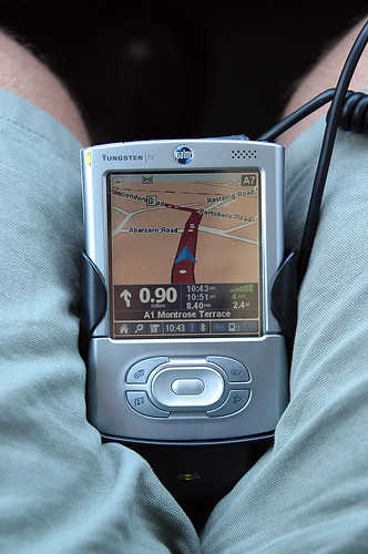
When we go to practice or cultural urban tourists usually buy a guidebook to the city or cities to visit, and maybe supplement with extra information: expanded documentation of the sights you want to visit with schedules, prices, historical data, etc… and moreover we print more specific plans of the city and its main transport. Couple this material will have a very good base to explore the site secured.

Photography by Martin Burns
However, transport is not accustomed to point and lines day and night buses, trams, etc. we could come to marvel at more than one occasion when we are on the ground, in order to optimize the time devoted to the transportation between sites. In addition, continuously display an entire plane for quick reference is not very practical.
If you have a pda or smartphone, we’re lucky with Metro, a free application which offers guides carry more than 350 cities in the world, with extremely fast query speed.
Métro we trace a path between two points, combining different means of transport available if needed. One of the advantages it provides is based on the current time to determine the routes, offering different options depending on whether you consult a mid-morning or one o’clock, when there is less available transport. Whenever possible we will show two routes: the fastest time and you need fewer transfers.
Another advantage of Métro is the meaning we mark the route, such as in rail route that will tell us to go from Paris to Versailles we have to take the RER C direction Versailles-RG, which will help us greatly put us on the correct platform. We also list all the stations along the way, very convenient to ensure that we were wrong. The information was finally completed with an estimate of the time that we invest in transit.
Métro is currently translated into 38 languages, and its use can not be more simple: the main screen enter the name of the nearest transit station from where we are, the station and Metro station automatically calculates the fastest route.
Métro is intended for tourists, for its ease of use by pressing find sites of interest, for use for example can tell you that we want to go to London Bridge or the British Museum. The database for each city keeps the most representative places of interest there.
The only flaw we’ve found is that you can not show street names and origin and destination. So, if you’re not at a point of interest or know the name of a subway station or bus stop nearby, it is difficult to plan a route.
The beauty of this application system is that it is portable and the other advantage is that it is completely free and is continually updated and expanded database of cities.
Métro platform is available for Palm, Symbian and PocketPC. We also have an online version if you want to see from our web browser: this is in: http://imetro.nanika.net/metro. Download Metro at the following address: http://chotto.free.fr/tatami/Metro/
Happy travels!
Leave a Reply
You must be logged in to post a comment.
Recent Comments